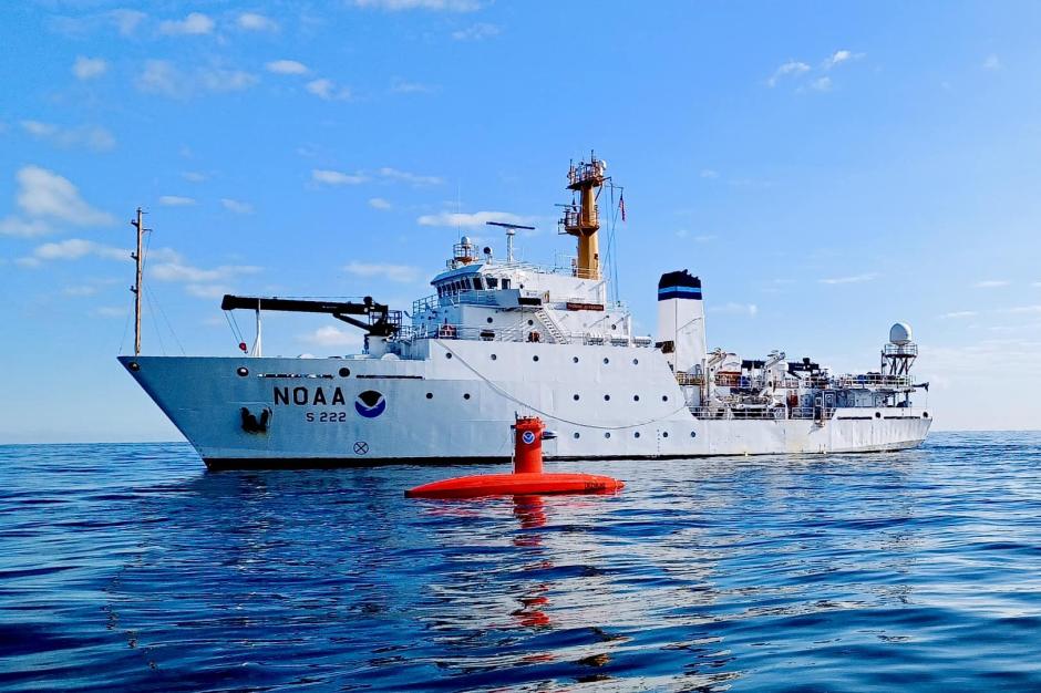
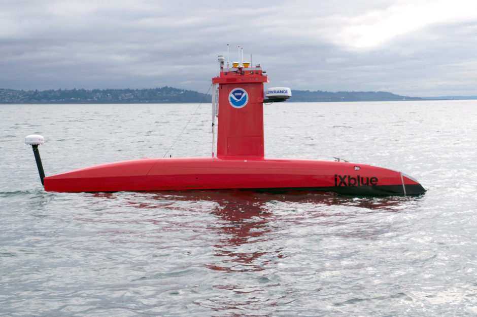
What’s a DriX? An overview of NOAA’s newest uncrewed surface vehicle
At NOAA, we are always looking for the safest and most efficient way to collect the data we need. These days, innovative technology plays a big part in that.

The .gov means it’s official.
Federal government websites often end in .gov or .mil. Before sharing sensitive information, make sure you’re on a federal government site.
The site is secure.
The https:// ensures that you are connecting to the official website and that any information you provide is encrypted and transmitted securely.
At NOAA, we are always looking for the safest and most efficient way to collect the data we need. These days, innovative technology plays a big part in that.
NOAA Corps recruiters will be attending the events listed below in 2023. Follow us on Facebook and Instagram for details as the event approaches.
February
Feb. 8 - Boise State Career Fair, Boise, ID, 1000-1400
Feb. 14 - Alabama A&M University Virtual Fair, Virtual, 1100-1500

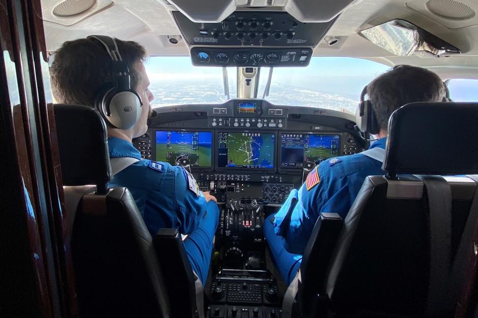
In this NOAA Corps officer profile, we catch up with NOAA Twin Otter pilot Ensign Sarah Cozart, who is currently assigned to the NOAA Aircraft Operations Center in Lakeland, Florida.
How did you become interested in science and aviation?

The NOAA Office of Marine and Aviation Operations deployed its Gulfstream IV-SP research jet to Hawaii in December to gather data on atmospheric rivers to help forecasters and water managers on the West Coast.

During the 2022 Atlantic Hurricane Season, NOAA Hurricane Hunter aircraft flew more than 582 mission hours to collect atmospheric data that is critical to hurricane forecasting and research, passing through the eye of a hurricane 65 times and deploying over 1,700 scientific instruments.

After a significant Lake Erie lake effect snow event, a NOAA King Air 350CER flew several surveys on Nov. 22 and 23 near Buffalo in western New York.

NOAA Ship Thomas Jefferson, a seafloor mapping and charting ship, completed a series of surveys in the Great Lakes in 2022. In all, the ship surveyed 450 square nautical miles of lake bottom in Lake Erie and 274 square nautical miles in Lake Ontario.