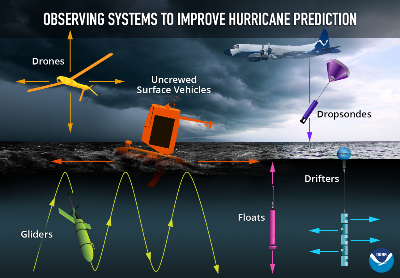
While hurricane season in the Atlantic Ocean occurs from early June to late November, NOAA personnel and their partners work throughout the year to provide critical information to protect lives and property during current and future hurricane seasons. Uncrewed systems have become an increasingly used tool in gathering information within hurricanes as they can sample parts of the storm system that crewed platforms cannot access.
NOAA works with experts across industry and academia to develop their ability to deploy uncrewed systems to gather critical, and otherwise inaccessible, data from hurricanes. With this data, NOAA aims to better understand hurricanes and improve hurricane forecasts. Let’s take a look at some of NOAA’s investments in uncrewed systems to support hurricane research.
Saildrone uncrewed surface vehicles
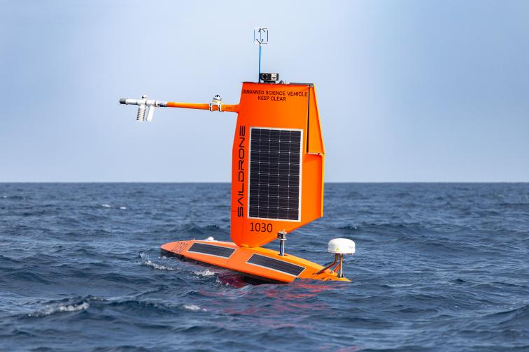
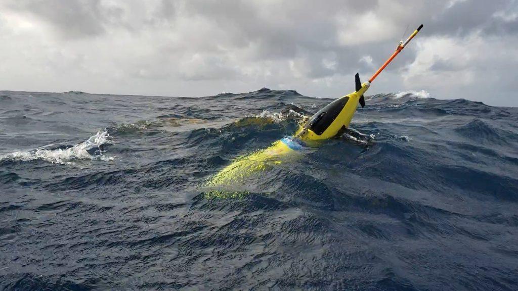
Since 2021, NOAA has worked with Saildrone Inc.; the Cooperative Institute for Marine and Atmospheric Studies; and the Cooperative Institute for Climate, Ocean, and Ecosystem Studies to deploy uncrewed surface vehicles into tropical storms and hurricanes. The uncrewed surface vehicles are equipped to measure near-surface atmospheric and upper-ocean conditions and gather videos and images from outside and within hurricanes. The effort has advanced throughout the years, with more platforms deployed and improved awareness of the utility of the platform.
In early 2025, experts from the NOAA Atlantic Oceanographic and Meteorological Laboratory, Pacific Marine Environmental Laboratory and Uncrewed Systems Operations Center met with Saildrone Inc. to review the successes and lessons learned from the 2024 hurricane season. In 2024, Saildrone uncrewed surface vehicles were able to perform 16 storm intercepts through seven hurricanes. This allowed more mission critical data to be gathered from within the storms, four of which made landfall within hours of the intercepts. The public-private sector team considered the overall mission a success. They identified areas to improve future uncrewed hurricane missions and the utilization of that data to improve hurricane awareness.
Learn more about past Saildrone missions here.
Plane-deployed uncrewed aircraft
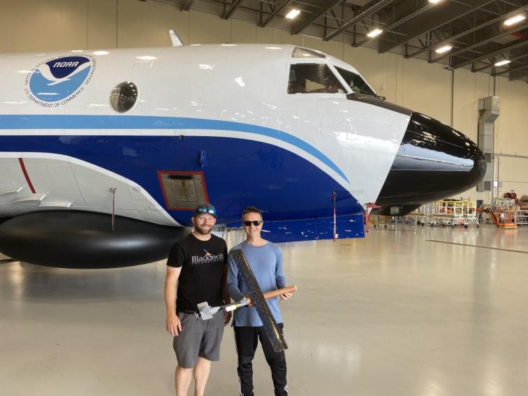
Since 2014, NOAA has explored using a variety of uncrewed aircraft to gather data within hurricanes. Early efforts to deploy uncrewed aircraft to gather hurricane data focused on the Raytheon Coyote that was originally developed for military applications. More recent efforts have focused on the Anduril Altius-600 and Black Swift S0 uncrewed aircraft that were both developed via partnerships between NOAA, industry and academia. With these uncrewed aircraft, NOAA and partners flew straight into the Guinness World Records book by setting a record for the longest endurance flight inside a tropical cyclone by an uncrewed aircraft in 2022, and then breaking that record in 2024. More importantly, these platforms help gather previously inaccessible data to inform hurricane awareness in real time. The platforms are able to collect information about atmospheric pressure, temperature, moisture, wind pressure and other variables throughout different portions of the hurricane.
The NOAA Uncrewed Systems Operations Center has identified air-launched hurricane uncrewed aircraft as a corporate capability they intend to grow for the agency, and is working with the NOAA Aircraft Operations Center and Atlantic Oceanographic and Meteorological Laboratory to operationalize the technology for use by the agency.
Learn more about this effort with the links below.
NOAA deployed new Altius drone into the eye of Hurricane Ian
NOAA deploys new Black Swift drone into Tropical Storm Tammy
Underwater gliders
Since 2014, NOAA has used underwater gliders to gather subsurface ocean observations in support of hurricane intensity forecasts. The NOAA Atlantic Oceanographic and Meteorological Laboratory, the U.S. Navy and academic partners via the NOAA Integrated Ocean Observing System Program partner to deploy and pilot the gliders throughout hurricane season. The gliders are deployed in a pattern to allow for maximum coverage of the regions where hurricanes often travel and intensify. Gathered data is incorporated into ocean models that inform hurricane forecasts.
The science team has used the gathered data to better understand the environmental variables that contribute to hurricane intensification and incorporated that data into ocean models to create a more realistic ocean environment for hurricanes to be forecasted with. Overall, this has improved the agency’s understanding of the ocean and hurricanes. For example, inclusion of ocean observations in simulations significantly reduced errors in wind intensity forecasts prior to Hurricane Michael making landfall. Glider-gathered data throughout hurricane seasons has emphasized the value of sustained and targeted ocean observing to improve hurricane forecasts and awareness.
Learn about NOAA’s hurricane glider operations here.