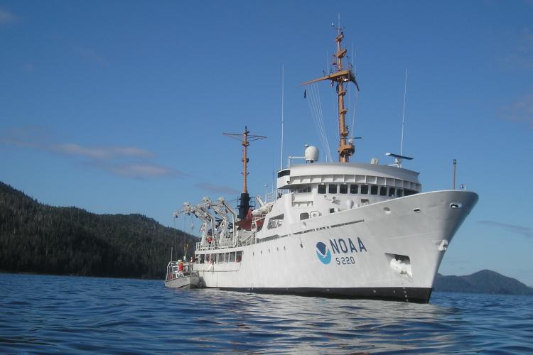
Credit: NOAA
Specifications
Contact Info
Ketchikan, AK
United States
About the ship
NOAA Ship Fairweather was built by Aerojet-General Shipyards in Jacksonville, Florida. The ship was commissioned on April 10, 1968 and is currently homeported in Ketchikan, Alaska. This hydrographic survey vessel primarily maps coastal waters to update nautical charts and mainly operates in Alaskan coastal waters.
NOAA Ship Fairweather maps the ocean to support safe navigation and commerce. Fairweather’s officers, technicians, and scientists collect data that NOAA cartographers use to create and update the nation’s nautical charts with ever-increasing precision. In addition to supporting marine navigation, Fairweather’s data is also used for marine ecosystem studies, fisheries habitat mapping and ocean research.
The ship’s side scan sonar can collect imagery of the sea floor, pinpoint obstructions or wrecks that could be navigational hazards, and identify characteristics of interest to biologists and geologists. The sonar emits sound waves in a swath, which generates a detailed image of objects on the seafloor.
To obtain accurate depth measurements (within 10 centimeters), the ship uses multibeam echo sounders. The bathymetric data can be converted into three-dimensional models to provide extremely accurate depths and detailed images of the sea floor and objects. The ship also has hydrographic survey launches that conduct surveys in shallower water depths the ship cannot access. The launches are fitted with sonar similar to those used by the ship.
The ship is named after Mount Fairweather--the tallest peak in the Fairweather Range at 15,300 feet above sea level-- which is located in Alaska’s Glacier Bay National Park and Preserve. Captain Cook named Mount Fairweather in 1778.

